top of page


Maps.
Below are the maps I consulted to determine the location of each photograph as well as an interactive map showing the Hannum Tour route.

Hannum Farms map drawn by Dr. Joshua Eyre Hannum in 1952
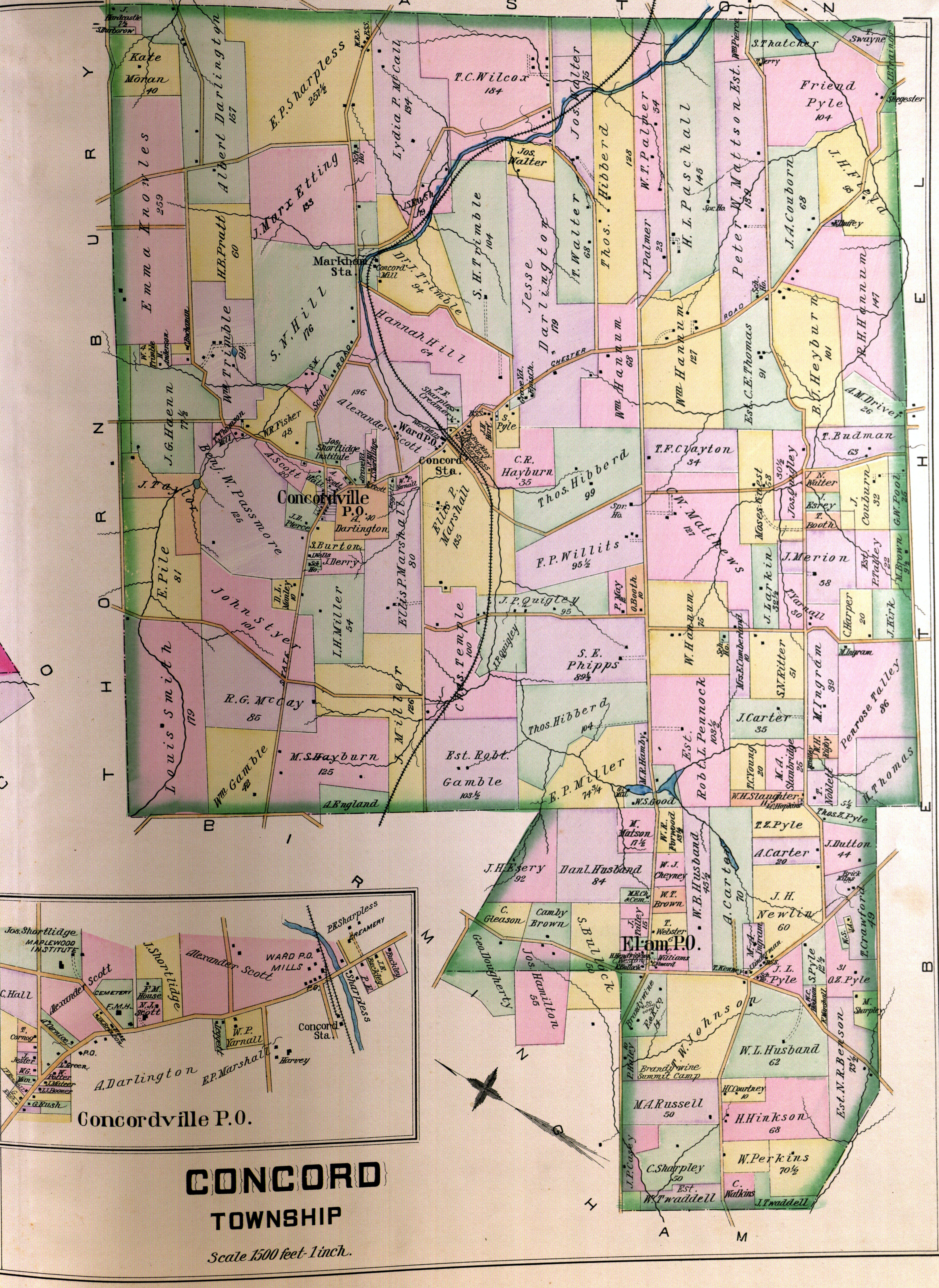
Concord Township 1892 Map

Concord Township 1911 Map

Concord Township 1934 Map
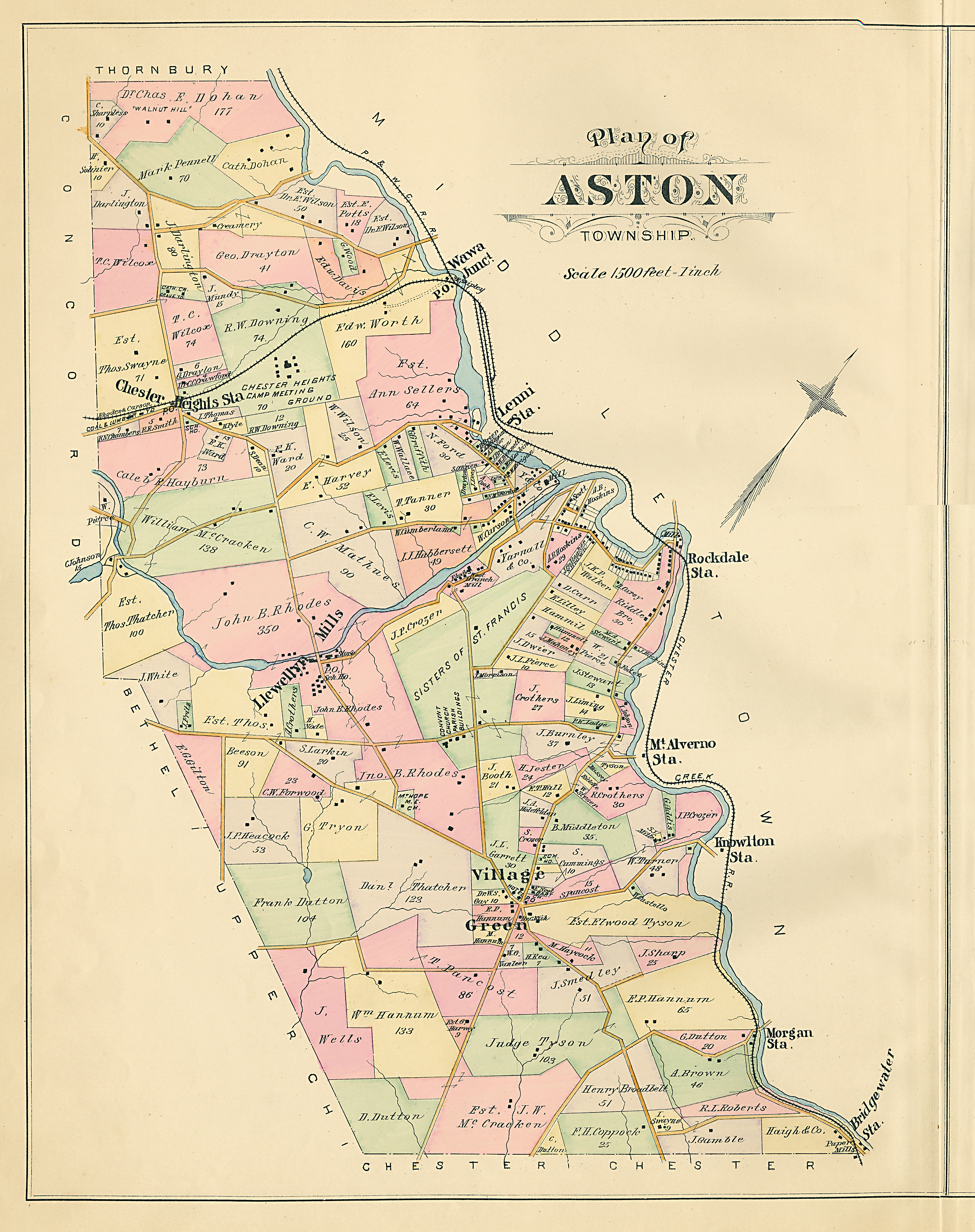
Aston Township 1892 Map
Hannum Tour Interactive Map
bottom of page